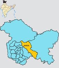
Jammu & Kashmir state is divided into three major regions, Ladakh, Jammu and the Kashmir valley. The state has two divisions Jammu and Kashmir and consiste of 22 districts. Major rivers flowing through the state are Jehlum, Indus and the Chenab.J&K is spread over an area of 222235 sq kilometers having China in the north, Tibet in the east, Himachal Pradesh and Punjab in the south, and Pakistani city Rawalpindi towards the west. Afghanistan is located in the North Western side. There are a number of Mountains ranges having a special geographical importance to the State of Jammu and Kashmir. These are Karakoram and Kyunlun Ranges,Zanskar Range,Nun Kun Range, Nanga Parbat Range, Harmukh Mountain, Burzil Mountain,Amarnath Mountain,Toshmaidan,Afarwat, P
Home Jammu & Kashmir-Geography


